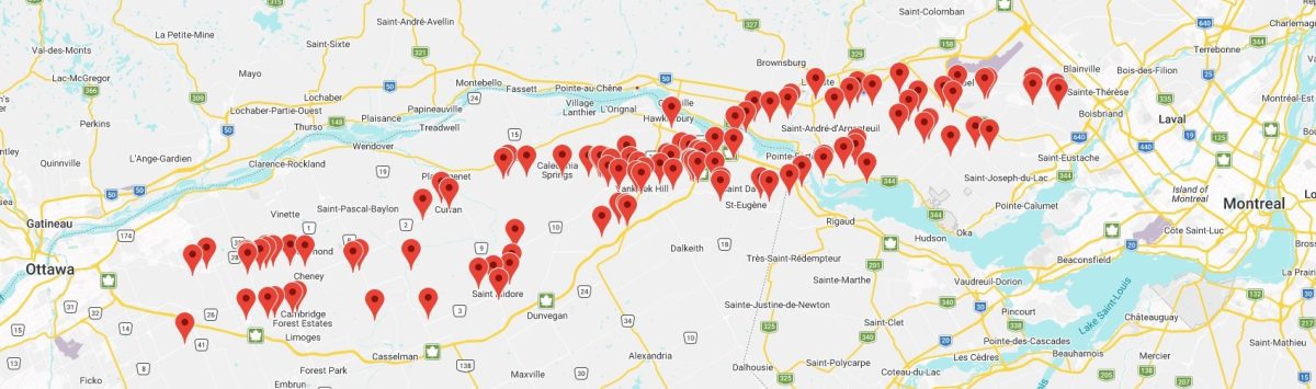
The final proposed route of the Ottawa to Montréal high-speed rail line is not to be announced until sometime in the fall of 2026, but a pattern is emerging of where it could possibly be. Based on the number of, and location of voluntary posts to an access map showing properties where Alto has contacted owners about performing environmental studies on their land, a couple of paths are possible. However, most of the reported contacts from Alto converge into a significant, single cluster around Vankleek Hill.
As of Wednesday, June 10, there were more than 115 documented examples on the access map of Alto contacting property owners from Navan and Edwards in the west to east of St-Augustin in Mirabel. Four of the documented contacts were from property owners in the centre of Vankleek Hill. One contact was in the centre of Hawkesbury, one in the centre of St-Isidore, and one in Chute-à-Blondeau. The other reported contacts were all from rural, agricultural and residential properties.
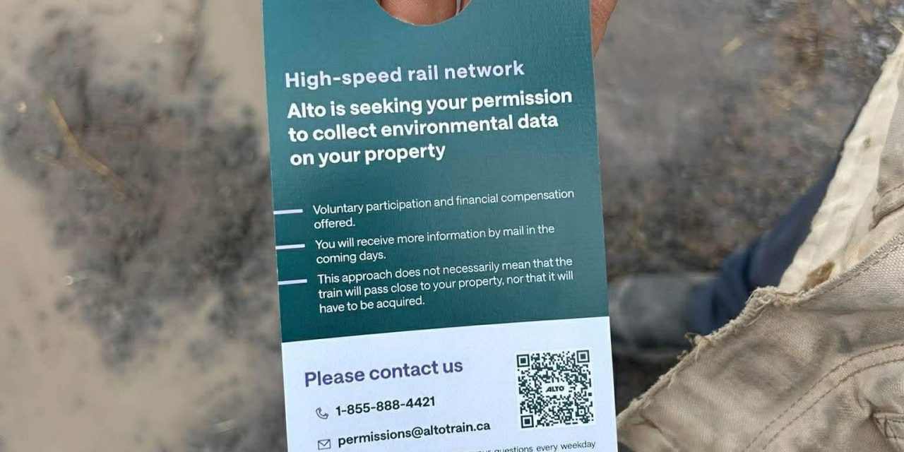
Landowners are not legally obligated to allow Alto personnel on their property.
The access map was developed by Alt-no, the main organization opposing the proposed Alto project.
The Ottawa to Montréal route has not been finalized. Planners began examining a 10-kilometre-wide area early in 2026 and will be reducing that area to about one kilometre wide once the route is determined.
Alt-no wants more landowners who have been contacted by Alto share it on the access map. That map can be accessed at https://www.altno.ca/accessmap.
Access Map as of June 10