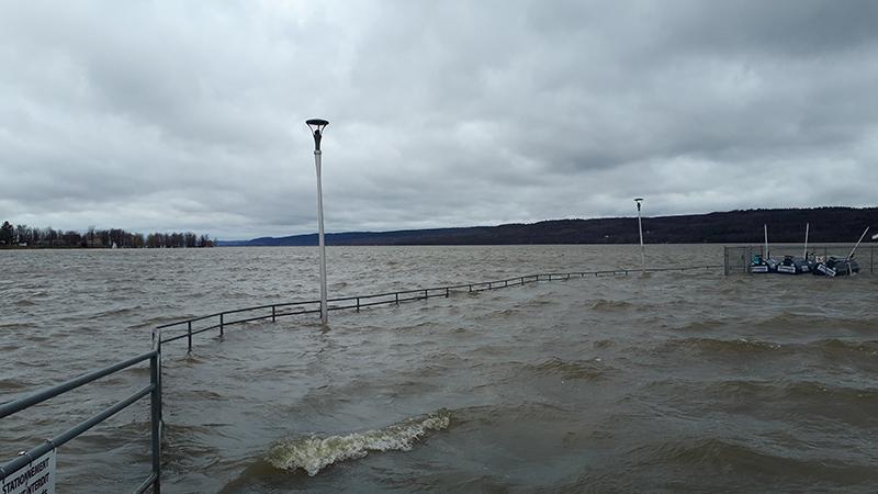
Water levels along the lower Ottawa River are still increasing due to spring runoff upstream in the Ottawa River basin. Peak water levels across many areas of the Ottawa River will exceed those experienced in May 2017 over the next couple of days, warns the South Nation Conservation Authority (SNC)
And on Monday afternoon, the SNC was warning of 20 to 40 mm of rainfall in the forecast for Wednesday into Thursday, May 2. An additional 10 to 20 mm of rain is possible on Friday, May 3, 2019.
Runoff from snowmelt, precipitation and saturated soil has swollen most of the Ottawa River’s tributaries.
Water levels in Clarence-Rockland and Alfred-Plantagenet have risen 0.12 m over the last 48 hours and are near those observed during the May 2017 flood. Levels are forecast to rise an additional 0.05 m to 0.25 m above the May 2017 levels over the next two days.
Due to the forecast uncertainty it is difficult to accurately predict how quickly water levels will rise and when river conditions may peak.
Risks
All flood-prone areas along the Ottawa River from Lac Coulonge to the Montreal Archipelago are at risk.
Levels will remain high and are forecast to peak between Tuesday and Wednesday. This is highly dependent upon the amount of precipitation that is received.
The SNC notes that water levels in the Constance Bay area have exceeded levels reached in May 2017. Water levels are forecast to rise an additional 0.30 m to 0.50 m above the 2017 levels.
Water levels in the Britannia area (Grandview Road, Britannia Village, and the Belltown Community) have exceeded levels reached in May 2017. Water levels are forecasted to rise an additional 0.30 m to 0.50 m above the 2017 levels.
Water levels east of Cumberland Village (Boise Village, Morin Road, Leo Lane) are slightly below levels reached in May 2017. Water levels are currently forecast to rise an additional 0.20 m to 0.40 m above the 2017 levels.
Monitor your own situation closely
Residents in flood-prone areas are encouraged to closely monitor conditions and take necessary actions. Sandbags are available to residents in flood prone areas.
Residents are advised to stay away from watercourses where flows are high and where banks might be unstable. Parents are encouraged to explain dangers to children.
This Flood Warning is in effect until Wednesday, May 1, 2019.
South Nation Conservation (SNC) and its Ottawa partners, the Rideau Valley and Mississippi Valley Conservation Authorities, monitor the water levels and weather forecasts with the Ministry of Natural Resources and Forestry as part of the Flood Forecasting and Warning Program. Updates are provided as conditions change.
The Ottawa River Regulation Planning Board will be reassessing forecast conditions and providing hydrological condition updates on its website daily at www.ottawariver.ca/forecast.php.
Please visit www.nation.on.ca for more information. To provide feedback with respect to changes in water related conditions please email [email protected], post on our Facebook (/SouthNationConservation) or Twitter (@SouthNationCA).
For more information regarding the Ottawa River, visit www.ottawariver.ca.


