Flooding along Rivière du Nord has significantly increased in severity.
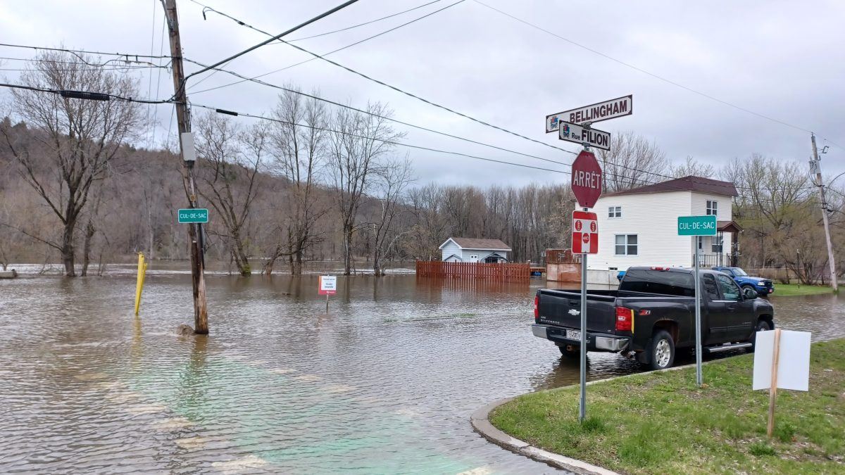
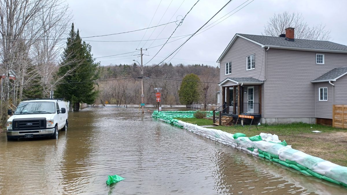
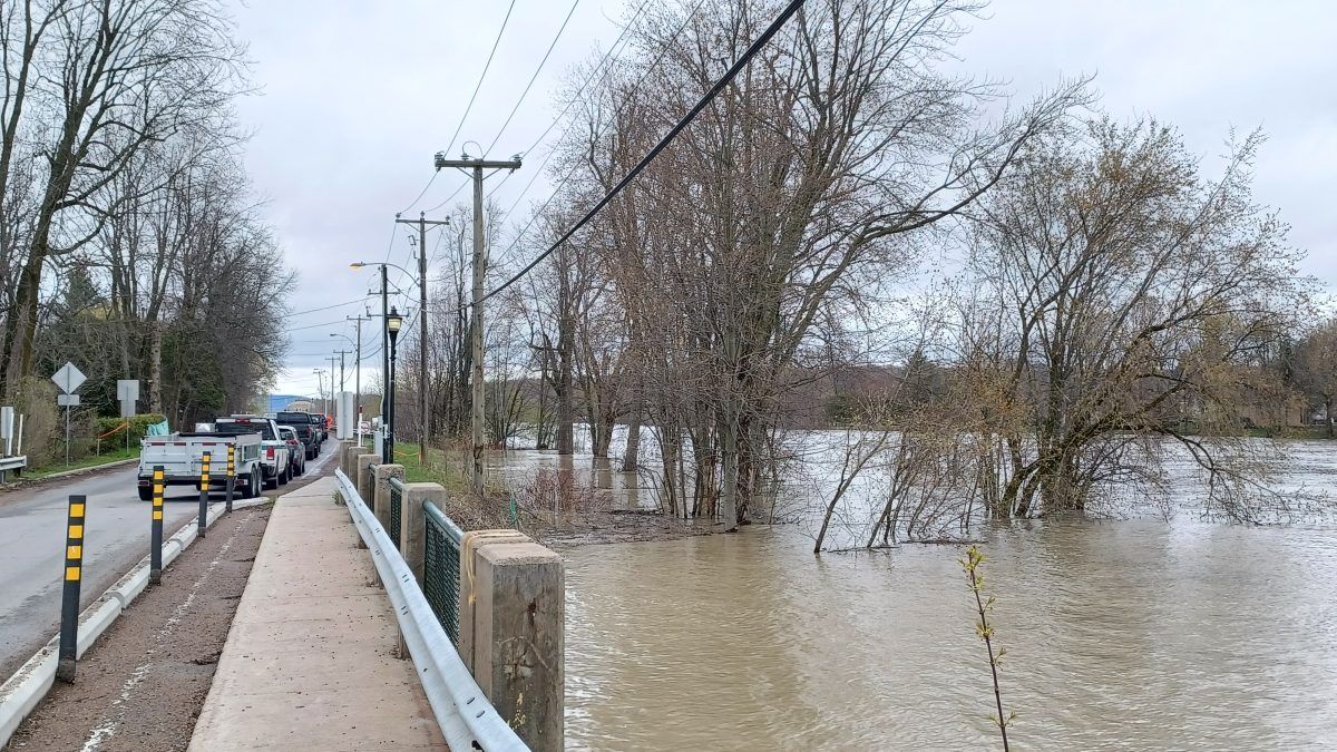
In Lachute, all or part of several streets north of the downtown area within two blocks of the river were flooded on Wednesday, May 3. Rue Filion was completely flooded. Parts of rues Thomas, Harriet, Bellingham, Meikle, Water, Hope, and Clyde were also flooded. Parc Barron in the centre of Lachute, was completely inundated. The sections of affected streets are all closed to traffic.
Daphné Tessier was one of the residents at a series of sandbag depots the city of Lachute had established in the neighbourhood. She was busy filling sandbags with the help of neighbours to protect her house at the corner of rue Harriet and rue Filion. Her partner Michael DeCoste was over in the garage beside their home monitoring the five pumps he was operating to keep the property reasonably dry. Tessier said there was no water in their basement, and they hope to remain in their house as they did during the last serious flood in 2019.
“We’ll stay here,” Tessier said.
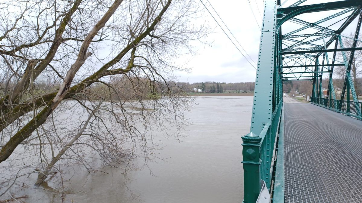
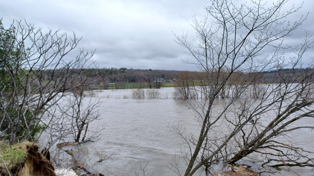
Upstream on Rivière du Nord, the water had turned chemin Dunany into a causeway across a large lake of beige water. Properties on chemin Laurin which back onto the river were flooded worse than in mid-April. Floodwaters had risen all the way to the bottom of the bank at the rest area located at the corner of Route 158 and Route 329, east of Lachute. Further east, part of Route 158 had been closed due to flooding. The river in that area is normally several hundred yards from the highway.
As of 2:15 p.m. Wednesday, the Québec government’s water flow monitoring station on Rivière du Nord in St-Jérôme had recorded a flow of 270.3 cubic metres per second with major flooding. However, the station also reported flows were beginning to decline. While flows may be declining there, the water still must travel south through Lachute and to St-André-d’Argenteuil where it enters the Ottawa River. The Québec government recorded rising water levels at a depth of 61.69 metres at its monitoring station in Lachute at 3:54 p.m. Wednesday.
St-André-d’Argenteuil
In St-André-d’Argenteuil on Wednesday, May 3, the municipality announced it will take 24 to 48 hours before the drop in water levels on Rivière du Nord being experienced in St-Jérôme begins to occur in St-André-d’Argenteuil. The Île-aux-Chats bridge remained open but under surveillance in case closure was necessary.
Crews were busy on Wednesday afternoon as they laid down gravel to temporarily raise the level of Route du Long-Sault (Route 344) where it runs beside the river southeast of St-André-Est. Work was also being done to temporarily raise the level of rue de la Seigneurie. Both roads are located in the lower reaches of the river, near where it enters the Ottawa River. Flooding remained significant in the low-lying neighbourhoods at the confluence of the two rivers with all roads being closed.
A regional emergency accommodation center is now open for residents affected by flooding. It is located at Arena Kevin-Lowe/Pierre-Pagé at 80 avenue Hamford, in Lachute. The Red Cross is on site to welcome the victims between 8:00 a.m. and 10:00 p.m.
Citizens who feel the need can dial 811 at any time to obtain psychosocial support. Info-Social 811 is a free telephone consultation service and confidential. The service is offered 24 hours a day, 365 days a year.
St-André-d’Argenteuil citizens who wish to voluntarily evacuate their residences must contact the municipality to advise of their departure. Citizens can communicate with the municipality at any time at 450 537-3527 ext. 0 or at [email protected] or dial 9-1-1 if it is an emergency.
To receive the latest updates, the public is invited to regularly consult stada.ca and the municipality’s Facebook page https://www.facebook.com/MunicipaliteSTADA, and to subscribe to the automated call service (SAM).
Video of flooding on Rivière du Nord
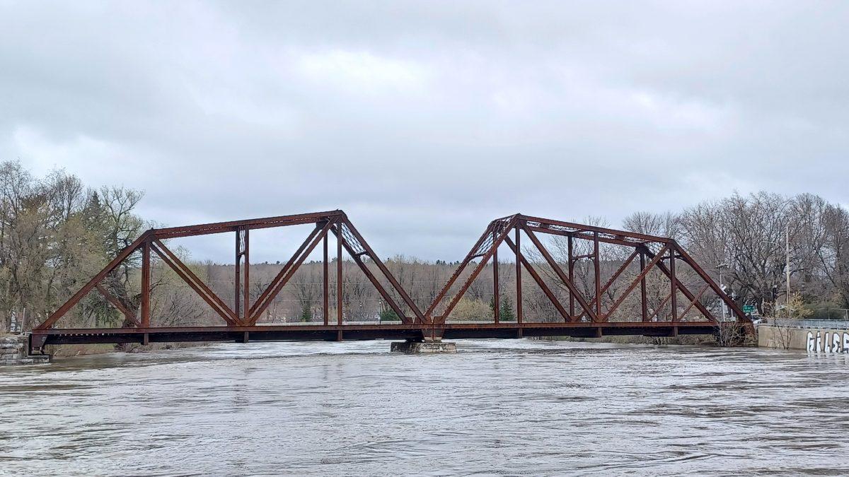
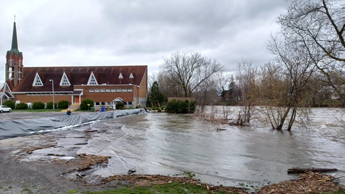
Rivière du Nord flood photos by James Morgan