UPDATED AT 1:30 PM on 05/04/2023
Floodwaters on the Ottawa River are expected to peak Thursday or Friday.
According to the Ottawa River Regulation Planning Board, flows and levels on the Ottawa River continued to rise on Wednesday, May 3 due to increased runoff from significant rainfall over the entire basin received over the last few days. Levels are expected to peak on Thursday or Friday from Chats Lake west of Ottawa down to the Hawkesbury/Grenville area. Levels should remain below the historical levels of 2019 by 50 to 60 centimetres between Ottawa-Gatineau and Hawkesbury/Grenville.
Water levels and flows are expected to stabilize into the weekend and should start to decline slowly into next week with the return of sunny and drier weather. Reservoirs in the northern part of the watershed, which are being used to store runoff and minimize flooding downstream, are rapidly filling. Once reservoirs are full, they will have little capacity to reduce river flows in downstream areas. Levels will therefore remain susceptible to further rise should additional significant rainfall occur over the coming few weeks.
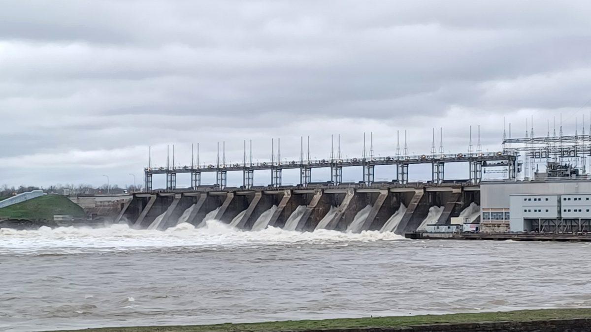
As of 8 p.m. on May 3, the water flow on the Ottawa River at the Carillon Hydroelectric Dam was 7,506 cubic metres per second. It was forecasted to reach 7,650 cubic metres per second on Thursday, May 4.
Video; Ottawa River at Carillon, May 3.
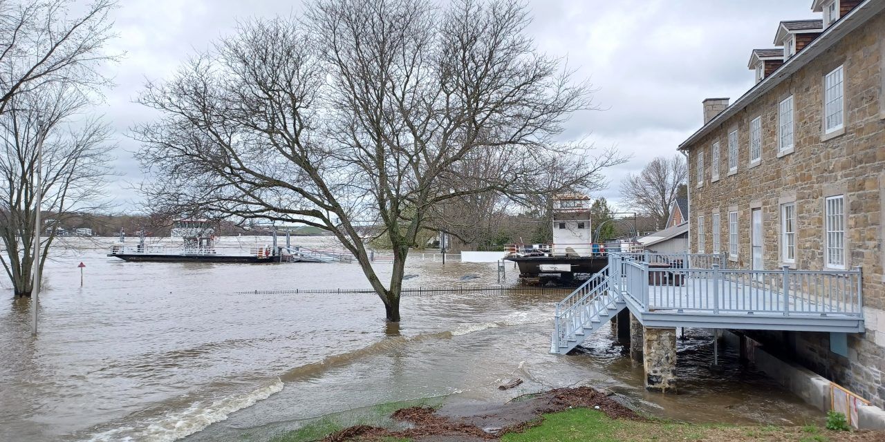
Between Ottawa-Gatineau and St-André-d’Argenteuil, Pointe-Fortune, and Rigaud on Wednesday, May 3, flooding was prevalent in low-lying areas on both sides of the Ottawa River. At 8 p.m. Wednesday evening, the Québec government flow monitoring station beside the ferry terminal in Masson recorded a water depth of 43.5 metres.
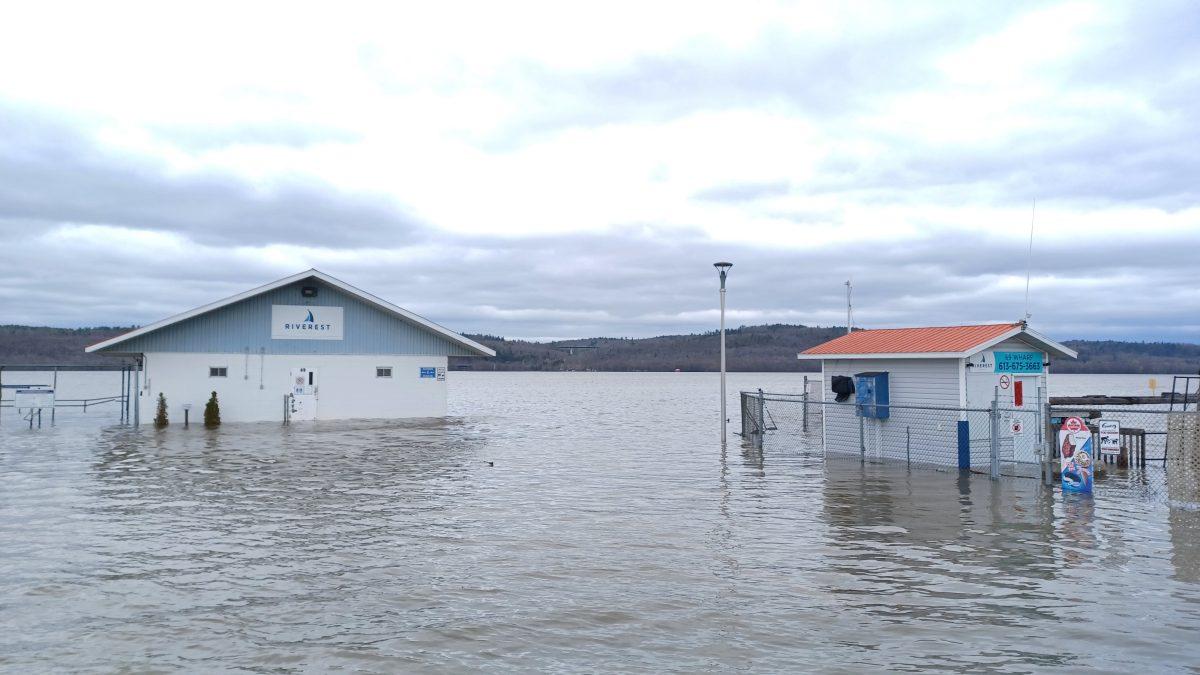
In L’Orignal on Thursday, May 4, the entire marina was flooded with water completely surrounding the two buildings. Montpetit Street, and several properties along it, were also flooded.
Champlain Township has left sand and bags for residents to use to protect their properties in neighbourhoods along the Ottawa riverfront. Residents requiring assistance from the fire department should call dispatch at 613-632-1105.
In the low-lying areas around Rigaud, the Québec government’s monitoring stations recorded water levels ranging from 24.58 metres to 24.47 metres, which are still within the minor flooding designation level of 25 metres on Wednesday evening.
The auto ferries between Cumberland and Masson, Lefaivre and Montebello, and Carillon and Pointe-Fortune are closed due to high water levels. At the Carillon ferry terminal on Wednesday, the water was very rough as it is downstream from the hydroelectric dam. Waves like those normally seen on large lakes were rolling ashore behind the historic Carillon Barracks, which had previously experienced flooding in 2019. Nearby, water was roaring through all of the spillway gates at the dam and the river had risen to the point where part of the berm separating the canal from main river channel had been submerged.
Ottawa River photos by James Morgan