Effective April 1, 2024, boundary changes will take effect for federal ridings, including those representing Prescott-Russell, Stormont, Dundas and Glengarry, Argenteuil, and the Rigaud area.
New federal riding boundaries have been determined through the constitutionally mandated redistribution process. If a federal election is held on or after the date the new boundaries take effect, the winning candidate will represent the new riding. The new ridings will remain in place until 2032.
Currently, there are 338 federal ridings. Voters in each riding elect one Member of Parliament to the House of Commons. Under the redistribution process, there will 343 ridings, and as a result, 343 Members of Parliament.
New federal electoral boundaries are determined by a representation by population formula in the Constitution. They are not determined by political parties. Federal electoral boundary commissions are created for each province.
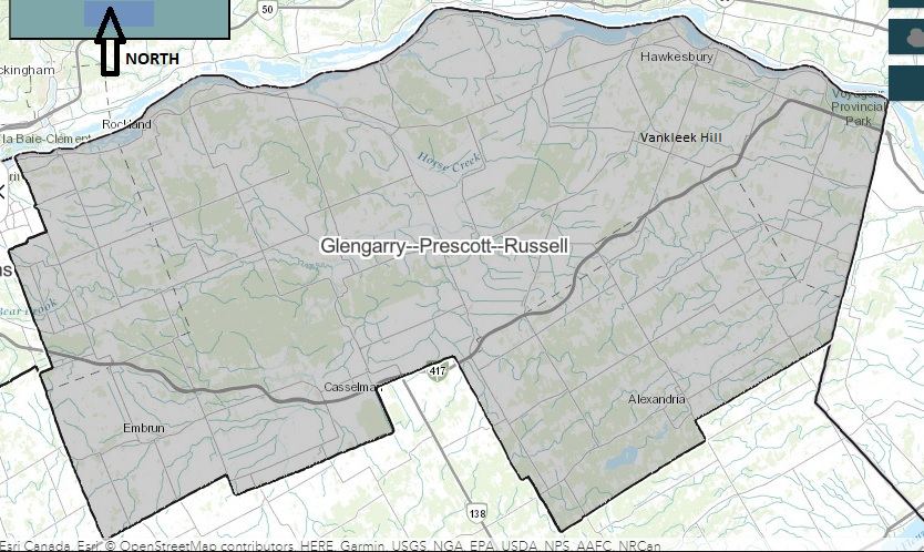
Under the new boundaries, North Glengarry will no longer be part of the same riding as Prescott-Russell. The new riding of Prescott-Russell contains the entire United Counties of Prescott and Russell (UCPR) territory, plus additional territory within the boundaries of the current City of Ottawa. This includes the communities of Edwards, Kenmore in what was formerly Osgoode Township in the historic County of Carleton. Most of the former Township of Cumberland, which was part of the UCPR until 1970, is also part of the new Prescott-Russell federal riding. The new riding has a population of about 111,163.
In July 2022, Township of North Glengarry council adopted a resolution requesting the Federal Electoral Boundaries Commission for Ontario include North Glengarry with the rest of the United Counties of Stormont, Dundas, and Glengarry. The current riding includes only South Glengarry but the entire SD & G territory, along with the City of Cornwall and the portion of Akwesasne within Ontario will be part of the new riding.
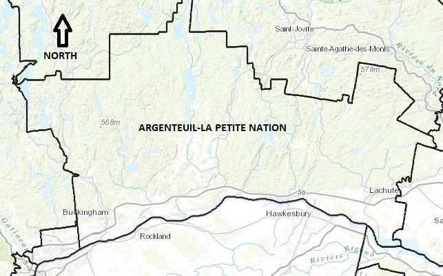
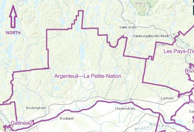
The Argenteuil-La Petite Nation riding will continue to have the same name and contain all of the Municipalité régionale de comte (MRC) d’Argenteuil, but adjustments will be made to territories it includes outside the MRC d’Argenteuil. More territory east of Lachute will be added from what is currently the Mirabel riding. North of Lachute, some territory will be ceded to a new riding called Les Pays-d’en-Haut. To the west, more territory from the rural part of Gatineau, L’Ange-Gardien, and Val-des-Monts is also being added to the riding.
South of the Ottawa River, the Vaudreuil and Salaberry-Suroît-Soulanges will remain in place, but with adjustments to their territory in their southern and western areas.
More maps of current and new federal ridings