
Municipal staff in Lachute and Brownsburg-Chatham have submitted changes to the Québec government about a map designating new flood zoning and regulations.
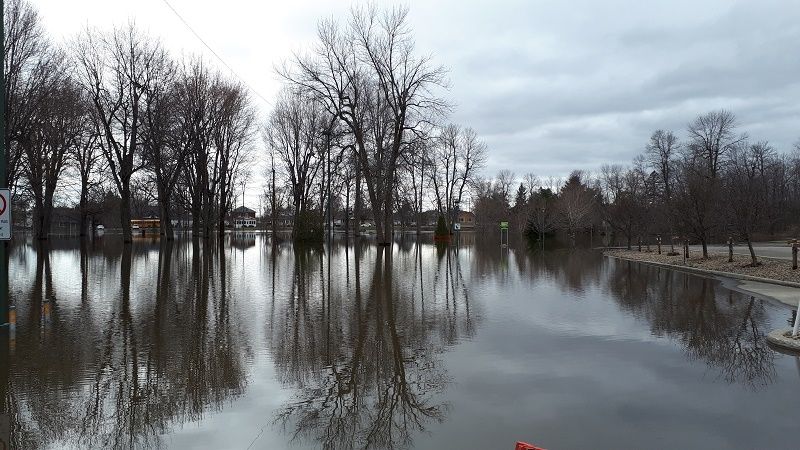
Municipalities have until August 19 to submit amendments to mapping of the Special Intervention Zone (SIZ) the government has created in response to serious flooding experienced in communities throughout Québec in the spring of 2019, and in 2017. The SIZ severely restricts development in flood –prone areas, including along Rivière du Nord in Lachute. Properties along the river in both the urban and rural parts of the municipality experienced serious flooding in the spring of 2019.
The satellite mapping done by the government identifies the zero to 20-year river current zone, the extent of flooding in 2017, and the extent of the 2019 floods.
In a municipal news release, Mayor Carl Péloquin stated that properties within the zero to 20 year current are already subjected to flood control regulations. However, some properties have been included in the SIZ even though they are outside the zero to 20-year area and were not affected by floods in 2017 and 2019. Péloquin said the municipality has notified the Ministry of Municipal Affairs and Housing about the inconsistencies.
Director-General Benoît Gravel explained that Lachute made its observations based on drone surveillance and on-the-ground observation before preparing the submission to the ministry.
Property owners who live outside the zero to 20-year zone but are within the SIZ and were not affected by recent flooding can request a change to the map by contacting the city of Lachute at 450-562-3781, extension 225 before August 14. All changes made by the city will be forwarded to the ministry. Property owners with technical questions can contact the municipal urbanism department at 450-562-3781, extension 207.
Brownsburg-Chatham
Properties along the Ottawa River and Rivière du Nord in Brownsburg-Chatham are also part of the Special Intervention Zone. The municipality has already made adjustments to the SIZ map created by the Québec government and is looking for input from citizens who want to suggest more changes. To do that, they should contact Urbanism and Sustainable Dev elopement Director Danielle Cyr by email at [email protected] or Clerk Pierre-Alain Bouchard at [email protected] before the August 19 deadline.