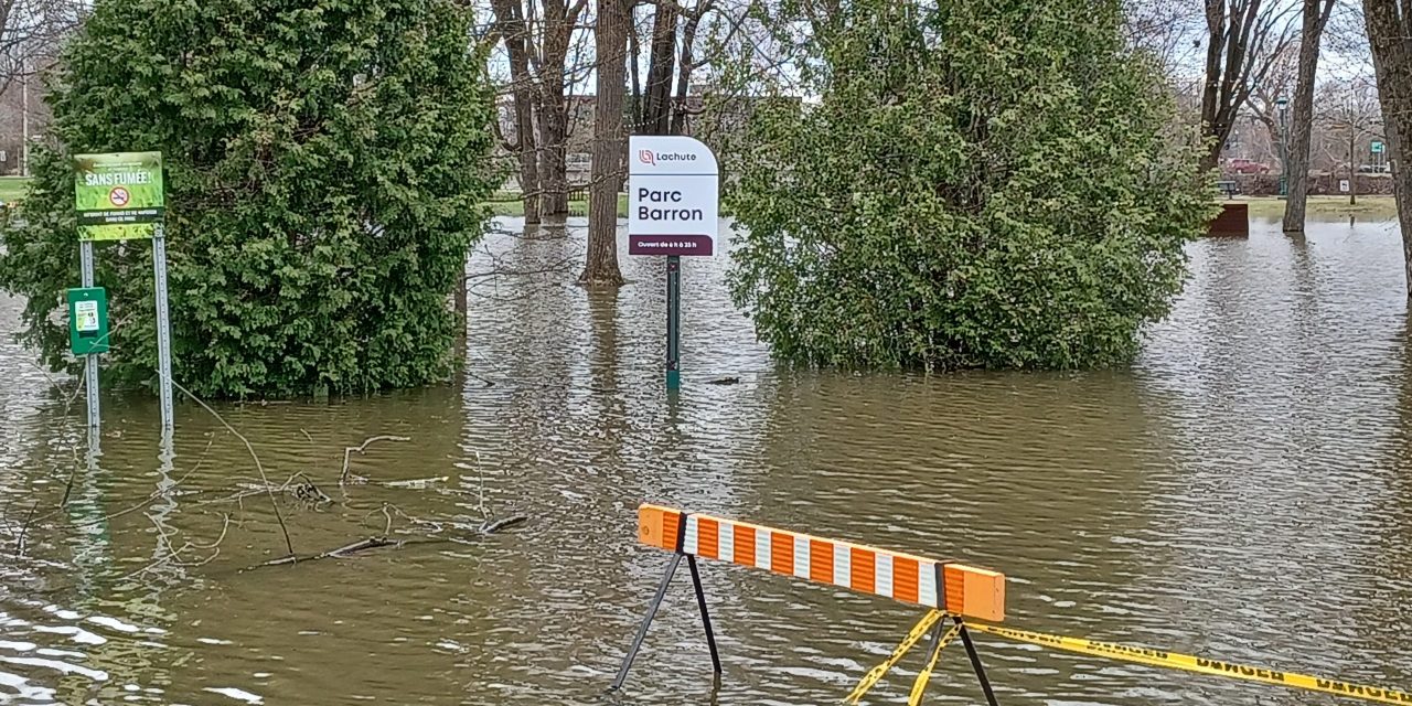
Parc Barron in Lachute underwater on Sunday, April 14. Photo: James Morgan
Spring flooding has begun on Rivière du Nord in Lachute and authorities are closely monitoring the situation.
As of the afternoon of Sunday, April 14, Parc Barron in the centre of Lachute was flooded. Some properties along the river on the northern edge of the urban area were also flooded.
The city of Lachute has set up sand and sandbag depots at various locations along streets where there is a higher risk of flooding homes and businesses.
In the morning of Tuesday, April 16, the Ministère de la sécurité publique du Québec listed the flood situation as normal in Lachute on its map of flood areas across Québec.
Floodwaters along Rivière du Nord in Lachute and Saint-André-d’Argenteuil could rise higher in the days ahead. On Sunday, the Ministère de la sécurité publique listed the flood situation at St-Jérôme as moderate but had changed to normal as of Tuesday. St-Jérôme is upstream of Lachute on Rivière du Nord so any water in the river there continues to flow downstream and collect from its tributaries to Lachute before entering the Ottawa River at Saint-André-d’Argenteuil.
To view the Ministère de la sécurité publique du Québec’s flood map, go to https://vigilance.geo.msp.gouv.qc.ca/carte.Photos: James MorganA sand and sandbag depot in Lachute.A flooded Parc Richelieu in Lachute.
After 20 years in journalism, James Morgan became Publisher and Editor of The Review in May, 2024. He strongly values the importance of keeping communities informed about the issues affecting them, sharing the good news from local events, and advertising as a way of growing the local economy.
The good food from the Good Food Garden is still growing. Peggy McDonald established the community supported agriculture (CSA) service in Vankleek Hill which provides fresh vegetables to subscribers back in 2020. Now, Ian Ruckriegel… Read more: Good Food Garden grows into new management
Vankleek Hill’s annual town-wide yard sale is back for another year on Saturday, June 6. Trash ‘n’ Treasure is presented by the Vankleek Hill Business and Merchant Association with support from Champlain Township. From 9… Read more: For your shopping pleasure, it’s Trash ‘n’ Treasure
We've placed cookies on your device to improve your browsing experience. They're safe and don't contain sensitive information. If you want, you can change your cookies through your browser settings. If you continue without changing your settings, we'll assume you're ok to receive all cookies on The Review website. For more information view our privacy policy.


 Parc Barron in Lachute underwater on Sunday, April 14. Photo: James Morgan