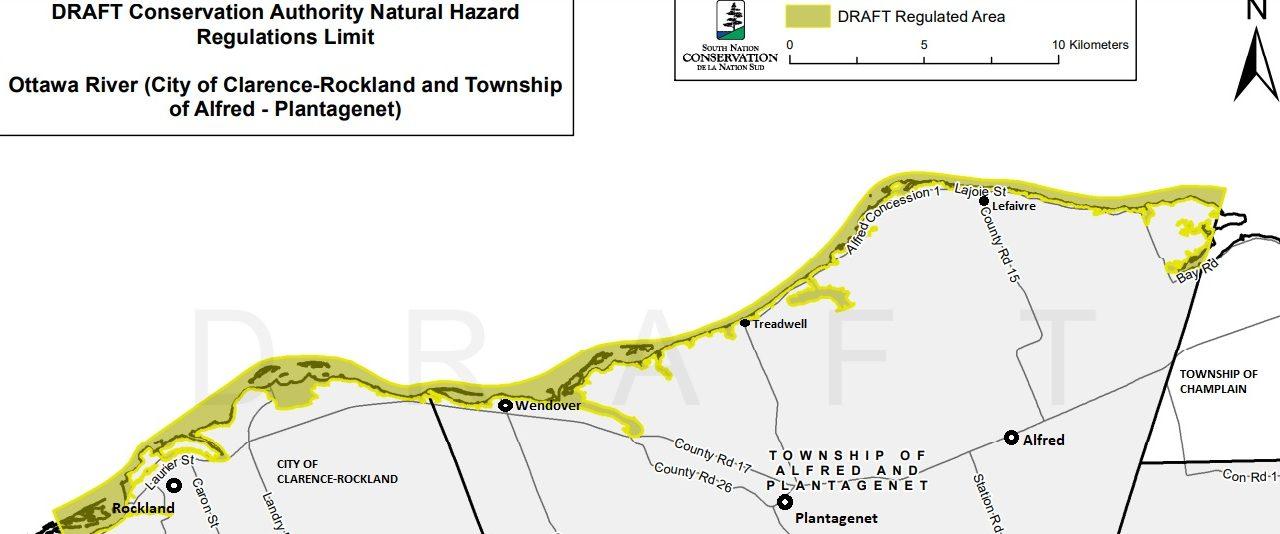
For the first time since the 1980s, Ottawa River Natural Hazard Mapping is being redone along the Ottawa River and its tributaries in Alfred and Plantagenet and Clarence-Rockland, and the draft maps indicate a dramatic reach of what future floodwaters and erosion could have in the area.
South Nation Conservation (SNC) is responsible for the new maps in each municipality. The public consultation period for the draft maps is also nearing its end. An open house on the draft maps was held on March 29 in Wendover but citizens who missed the open house may schedule a private meeting with SNC staff, either online or in-person at SNC’s office in Finch. Meetings are available weekdays and evenings between April 3 and April 14. To schedule a meeting, please call 1-877-984-2948 or email [email protected].
Natural hazard maps are used by municipalities and SNC when updating Official Plans for land use, and zoning schedules, and when reviewing development applications. The idea of the maps and the regulations regarding flood plains and other natural hazards are intended to protect people and property from natural hazards and guide sustainable development activities.
Development projects within natural hazard areas such as floodplains require permission from the conservation authority before proceeding. Both Alfred and Plantagenet and Clarence-Rockland are within the area of SNC’s jurisdiction, therefore permission is required, and provincial regulations apply. For further regulatory information, visit SNC’s Regulations Webpage to learn more about regulations made under Section 28 of the Conservation Authorities Act, (Ontario Regulation 170/06 Regulation of Development, Interference with Wetlands and Alteration to Shorelines and Watercourses).
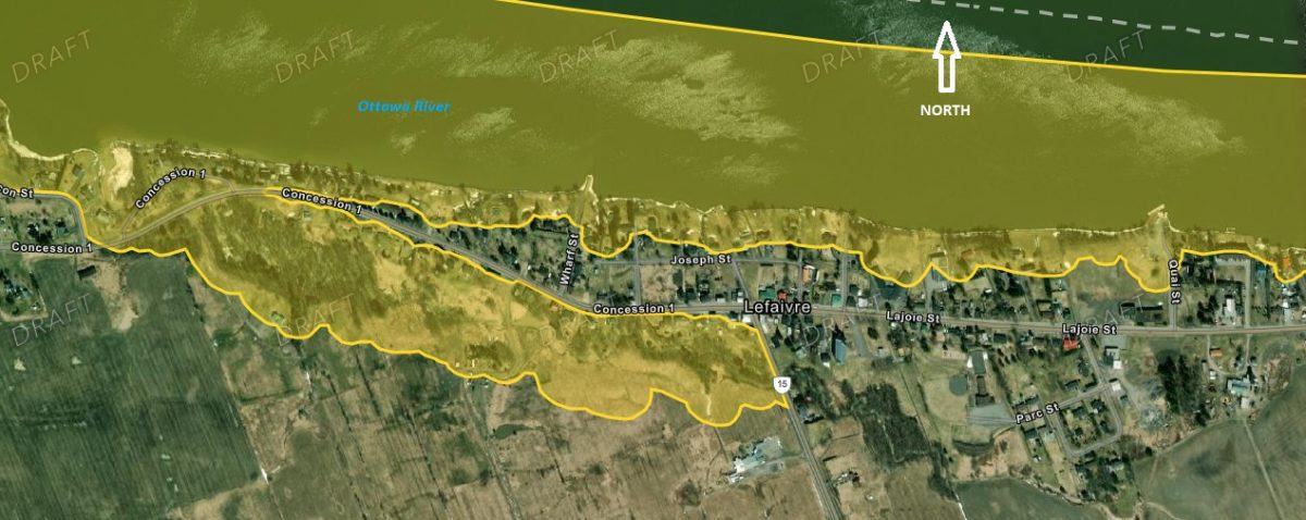
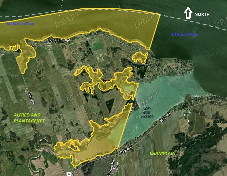
The proposed maps indicate significant natural hazards exist for properties and communities along the Ottawa River and its tributaries. These communities include Rockland, Treadwell, Wendover, and Lefaivre. The draft map shows almost the entire village of Lefaivre being surrounded by hazard zones. Other areas with significant hazards include Presqu’île, Jessup’s Falls, Baie des atocas, and La Domaine in Alfred and Plantagenet.
Serious flooding affected properties along the Ottawa River in Clarence-Rockland and Alfred and Plantagenet in 2017 and 2019.
Once the consultation period is complete, the maps will be submitted to the SNC board for approval, or rejection.
To view the draft maps, including with specific detail by property address, Click here to access the Interactive Property Map.