
The return of ice to local lakes is a reminder of a fatal airplane crash which occurred on Lac Barron in Gore on March 3, 2021. The federal agency which investigates aircraft clashes has released its report following an investigation of the incident.
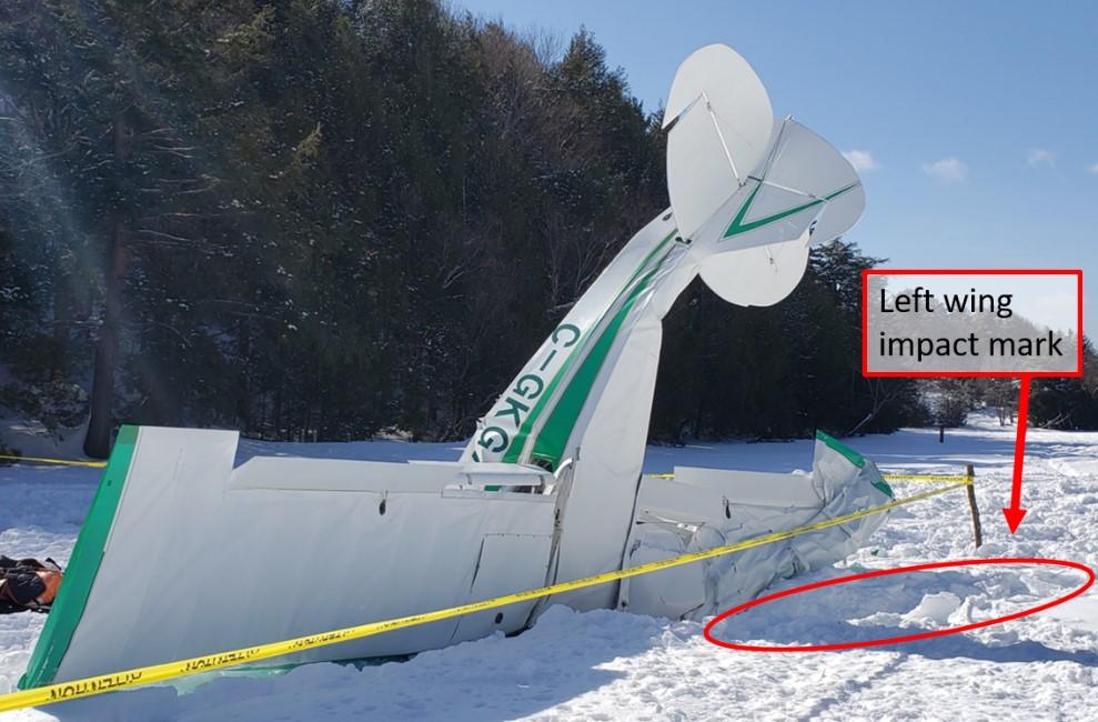
According to the Transportation Safety Board (TSB) of Canada report, a co-owner of the amateur-built Wag-a-Bond aircraft, registered as C-GKGX took off from the frozen lake shortly after 8 a.m. to meet the other co-owner at the Lachute Airport. The aircraft reached an approximate altitude of 50 feet above ground level after takeoff and then began to spin and crashed almost vertically, nose-down, onto the ice, with the left wing impacting the ice first. The pilot was fatally injured. A witness notified emergency responders and the TSB was contacted to investigate.
The TSB determined aerodynamic stall is what caused the aircraft to crash. A stall is a loss of lift and an increase in drag that occurs when an aircraft is flying at an angle of attack greater than the angle that provides maximum lift. It does not mean the aircraft engine stalled.
The TSB report states that the higher drag, caused by the flaps of the aircraft being set to 40 degrees, limited the aircraft’s speed during the climb. The engine torque at full power caused the aircraft to roll to the left and the slipstream on the stabilizer and rudder caused the aircraft to yaw to the left.
The TSB determined the pilot began a low speed left turn by applying the controls and left pedal, which is when the aircraft likely stalled, sending it into a spin. Due to the aircraft being at approximately only 50 feet above ground level when control was lost, it was not high enough for to avoid collision with the frozen lake.
The TSB is reminding pilots to watch for warning signs of a stall and use caution in handling flight controls to avoid stalling and the aircraft beginning to spin.

The Transportation Safety Board of Canada has determined aerodynamic stalling caused the aircraft, C-GKGX to crash on Lac Barron. This photo includes a diagram of the approximate flight path. Photo: Transportation Safety Board of Canada