
Effective Friday, April 14, the Ottawa River Regulating Committee has issued a Flood Watch statement for the Lower Ottawa River, which includes the area between Arnprior and Hawkesbury.
Due to significant snow melt and forecasted rainfall anticipated on Sunday and Monday, water levels are expected to continue rising within the Ottawa River Basin.
Most of the water currently entering the Ottawa River is located in areas where there are no reservoirs or retention capacity. The current strategy by the Ottawa River Regulating Committee is to reduce the amount of water released from the principal reservoirs to prevent water levels exceeding major flood levels.
The Ottawa River Regulating Committee anticipates that water levels along the main stem of the Ottawa River will exceed minor flood levels, impacting several streets and lawns in low-lying areas.
This includes flood-prone areas at Cumberland, Clarence-Rockland, Thurso and other vulnerable areas down to Montréal. Areas at greatest risk are located in Cumberland and Rockland.
While there are currently no major flooding indicators of concern, it is still too early to forecast peak river conditions which remain dependent on snowmelt and rainfall amounts.
Residents in flood-prone areas are encouraged to closely follow changing conditions and to take necessary measures. Residents are advised to stay away from watercourses where flows are high and where banks might be unstable. Parents are encouraged to explain dangers to children and provide appropriate supervision around all waterbodies.
The Mississippi Valley, Rideau Valley, and South Nation Conservation Authorities monitor water levels and weather forecasts with the Ontario Ministry of Natural Resources and Forestry as part of the Flood Forecasting and Warning Program. Updates are provided as conditions change.
The Ottawa River Regulating Committee will be reassessing forecast conditions and
providing hydrological condition updates on its website daily at www.ottawariver.ca/forecasts.
To view current flood warnings across Ontario, visit: www.ontario.ca/law-and-safety/flood-forecasting-and-warning-program.
The Flood Watch Statement is in effect until April 28, 2023, at p.m.
State of Emergency in Saint-André-d’Argenteuil
Flooding on has already prompted one municipality in Québec to take action.
At 4 p.m. on Friday, April 14, Saint-André-d’Argenteuil Mayor Stephen Matthews, declared a state of emergency in the municipality due to rising water levels. The municipality is located at the confluence of Rivière du Nord and the Ottawa River, and includes several high risk areas for flooding. All indicators have led the municipality to believe the rivers will overflow their banks.
The municipality has established filling stations for sandbags in the following high-risk areas:
o Fournier sector
o Île-aux-chats sector
o Baie de Carillon Sector
o Terrasse Robillard Sector
Also as of Friday evening, a temporary berm had been installed at the rest area beside Riviere du Nord in St-Andre-Est to prevent floodwaters from reaching Route 327 and Église St-André-Apôtre church.
Citizens who feel the need can dial 811 at any time to get psychosocial support. Info-Social 811 is a free, confidential, and bilingual consultation service available 24 hours a day, 365 days a year.
To receive the latest updates, residents are invited to consult regularly on stada.ca, the municipality’s Facebook page or subscribe to the automated call service (SAM). Citizens may communicate with the municipality at any time at 450-537-3527 or at [email protected], or dial 9-1-1 in an emergency.
Preventive patrols will continue to take place daily. The municipality continues to constantly monitor the entire territory and to adapt actions depending on the situation.
South Nation River
Late in the afternoon of Friday, April 14, the South Nation River was full and moving fast in the Fournier and Plantagenet areas with minor flooding in flat, low-lying areas. South Nation Conservation had last issued a Flood Watch Statement for the South Nation watershed on April 12 warning of high-water levels, fast flowing water, and slippery or unstable banks. Roads, driveways, and properties in flood-prone areas could be impacted.
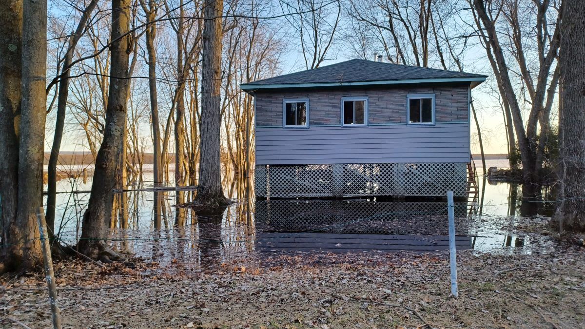
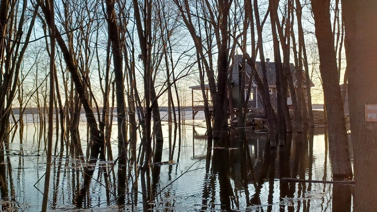
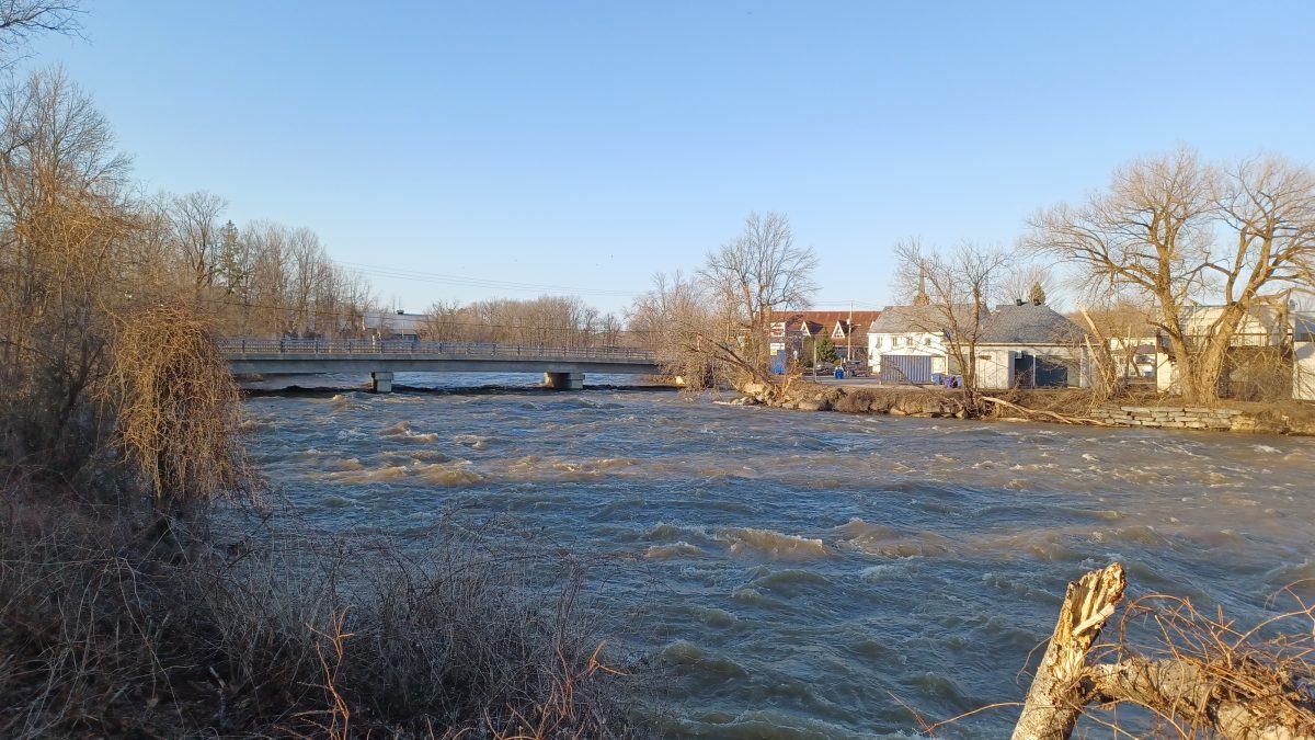
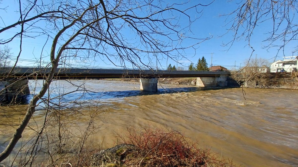
Photos of local rivers and flooding on Friday, April 14. All photos by James Morgan